For better user experience, please use another browser.
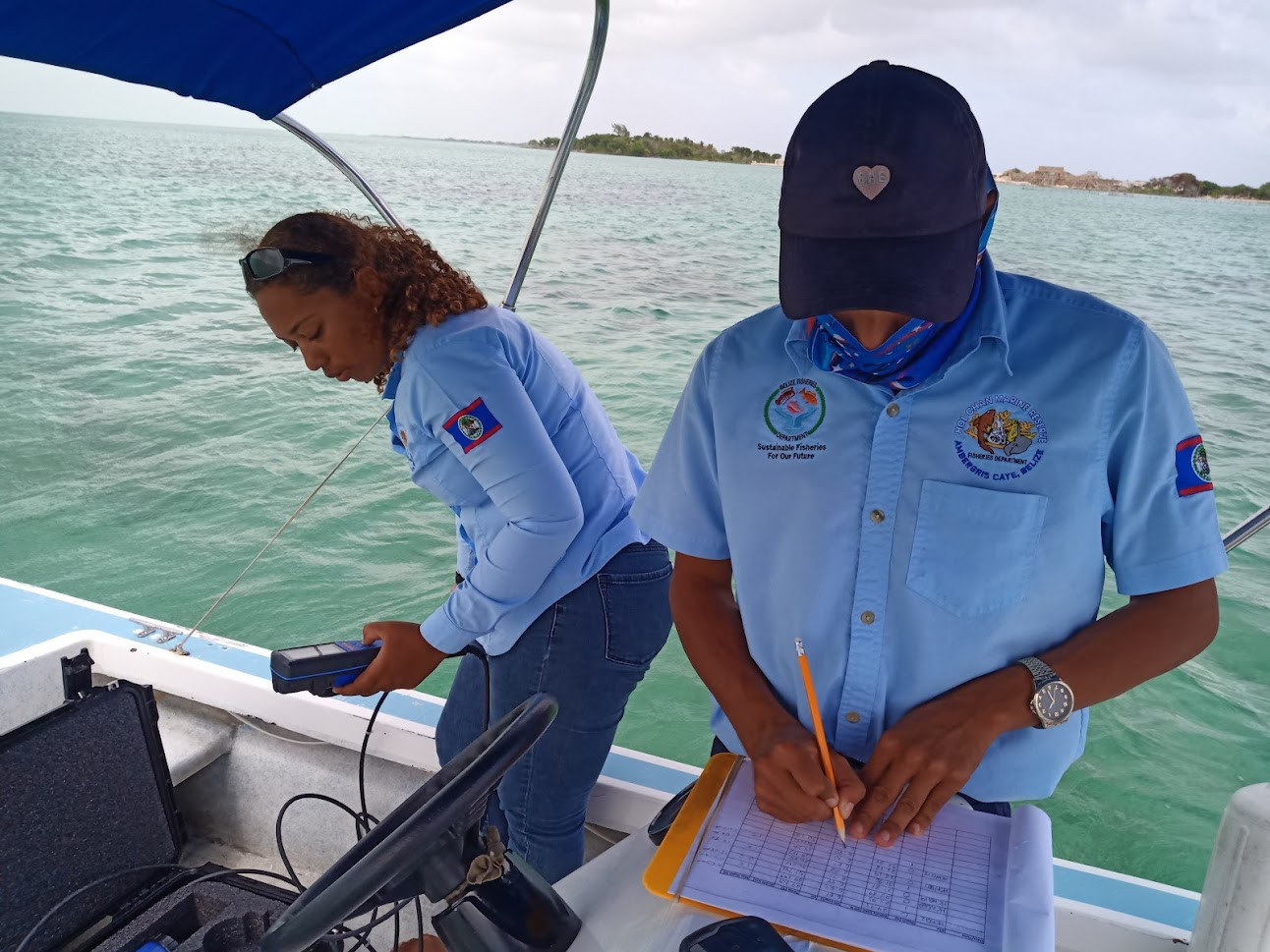
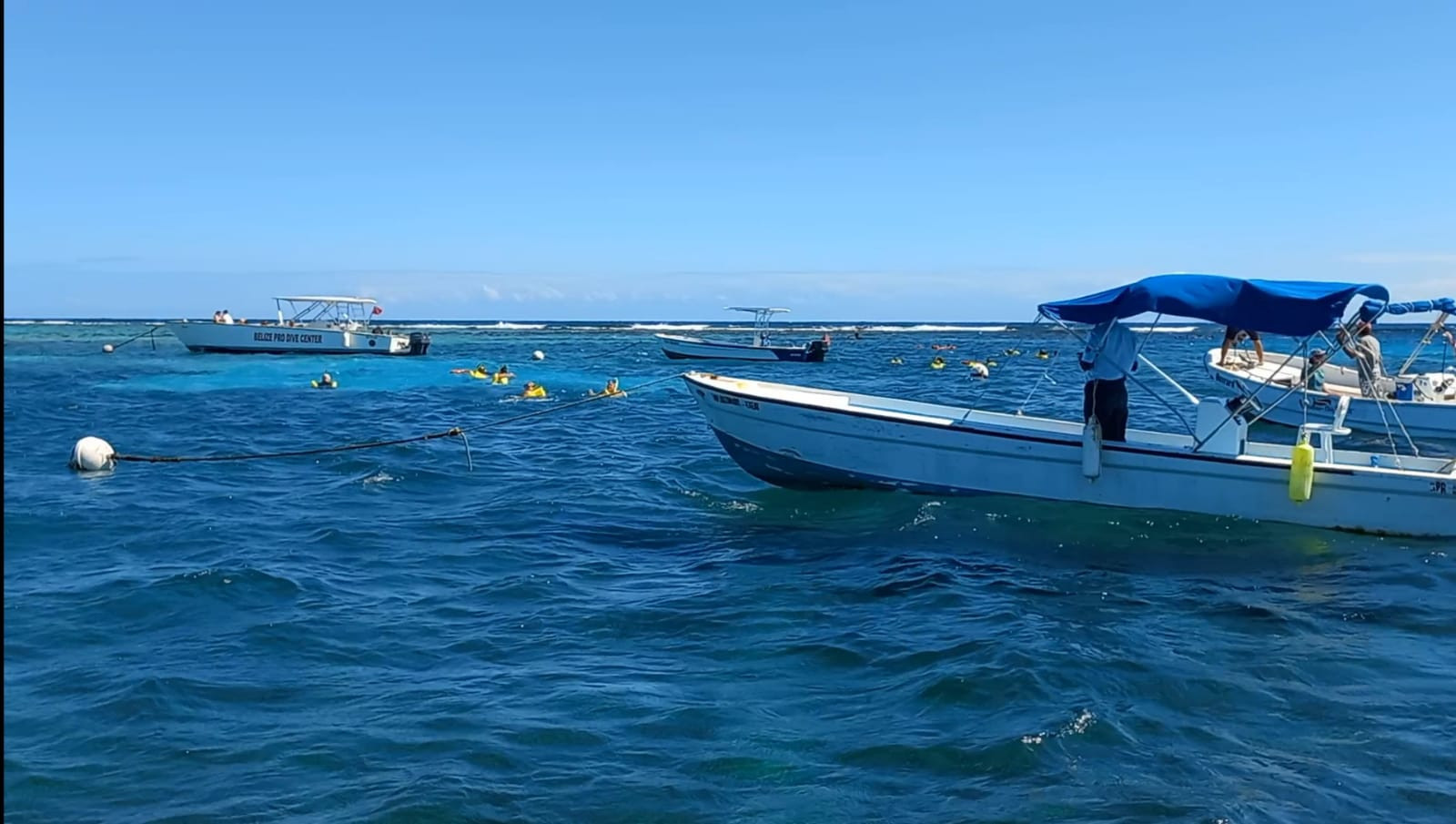
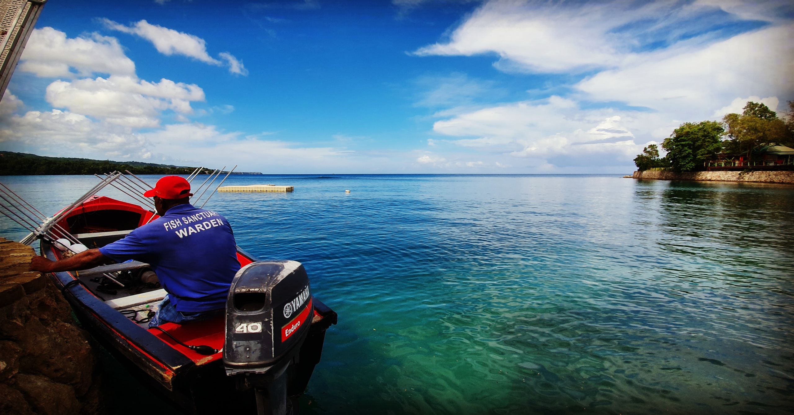
Hol Chan Marine Reserve
The grant addresses the need for financial assistance to sustain operational activities within the Hol Chan Marine Reserve, due to loss in revenues as a result of the COVID19 pandemic.
The project aims to support the effective management and governance of The Hol Chan Marine Reserve through continued patrols and environmental and biodiversity monitoring. With high unemployment rates and an increase in fishing activities it is important to maintain a presence to deter encroachment of fishing into the no-take and conservation areas. Funds will support staff salaries and the purchase of personal and protective equipment for staff members.
The project will include the development of strategies for financial diversification that allow management to cope with the current financial limitations because of COVID-19 and recover financial stability at a faster rate once the threat of COVID-19 has been reduced.
The project implementation will help to buffer the long-term effects/impacts due to the loss of revenues because of the COVID-19 pandemic. Financial obligations can be met and preventing the Reserve from plunging into a debt hole that would take a long time to recover from. Enforcement, biodiversity monitoring, education and outreach, and visitor management activities will continue to be sustained ensuring that the Reserve meet its conservation objectives.
Indirectly the project implementation will support community livelihoods by ensuring compliance with regulations and protection strategies, securing the livelihoods of over 300 license fishers, over 625 licensed tour guides, and 91 registered tour operators, and their families.
Download the project infofiche
Hol Chan Marine Reserve

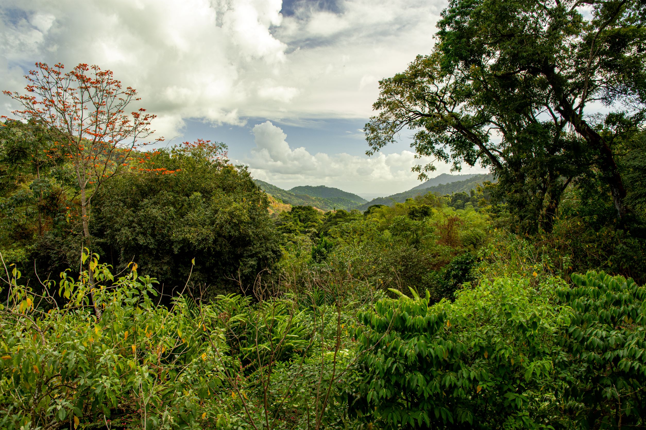
Asa Wright Nature Centre (AWNC)
The AWNC is a local NGO established in 1967 as a wildlife sanctuary and nature centre by a Trust Deed. The objectives of the AWNC are to protect the area, preserve the flora and fauna of the country, and continue and encourage its sustainable use for agriculture, scientific research and environmental education. The Trust was established without an endowment and it depends upon grant funding from donors and income derived from the operation of its lands and buildings, primarily the eco-lodge. The AWNC is not in receipt of any funding from the Government.
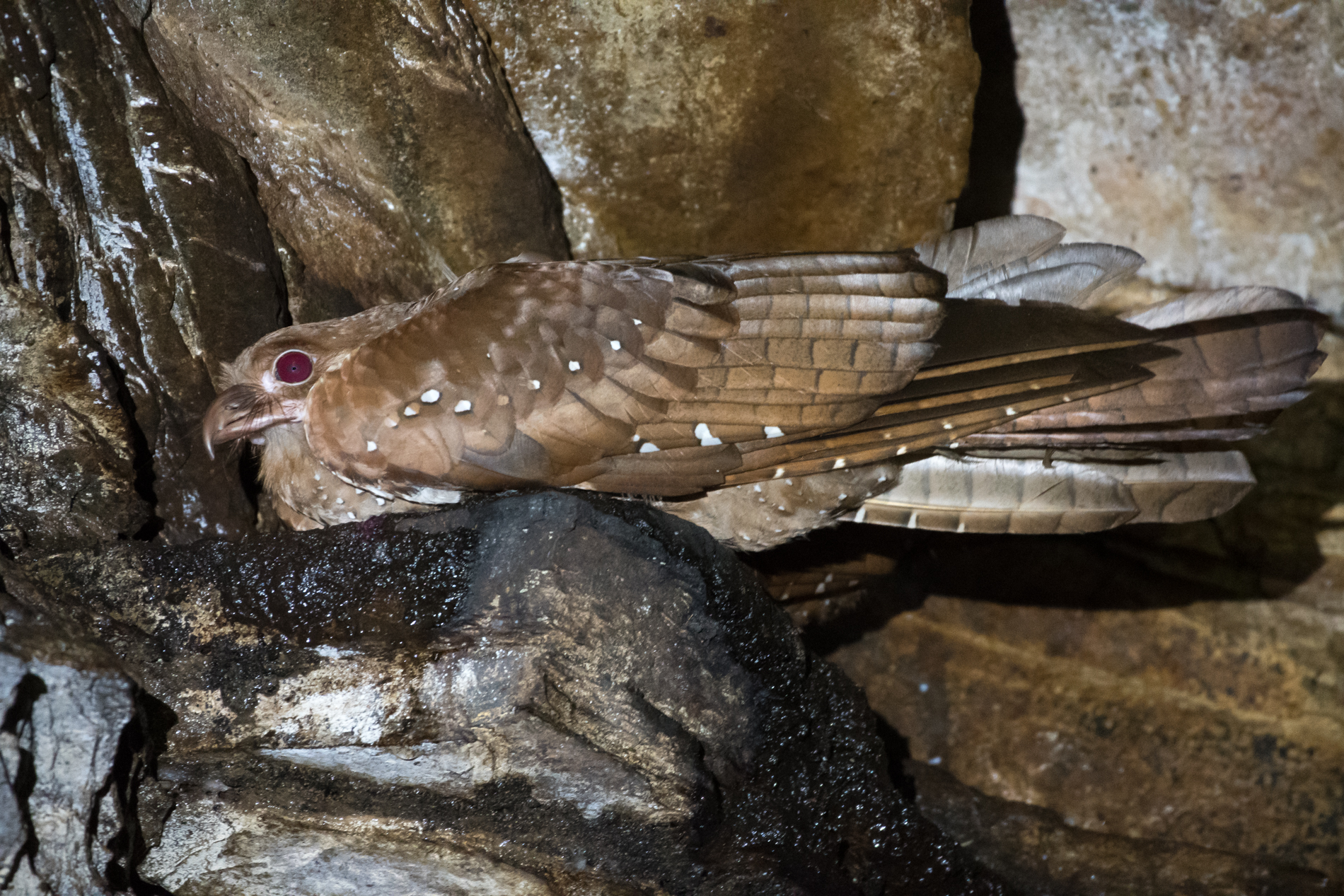
As a result of the Covid-19 pandemic and the closure of the borders of Trinidad & Tobago, the AWNC’s eco-lodge was closed to visitors in March 2020, and the consequent total cessation of the AWNC’s eco-lodge business occurred in mid-January 2021 in an effort to avoid insolvency. Even if the entire financial reserves of the Trust are drawn down, the basic expenditure required to provide continued protection of the protected lands and support key long-term wildlife monitoring programmes cannot continue beyond early 2022.
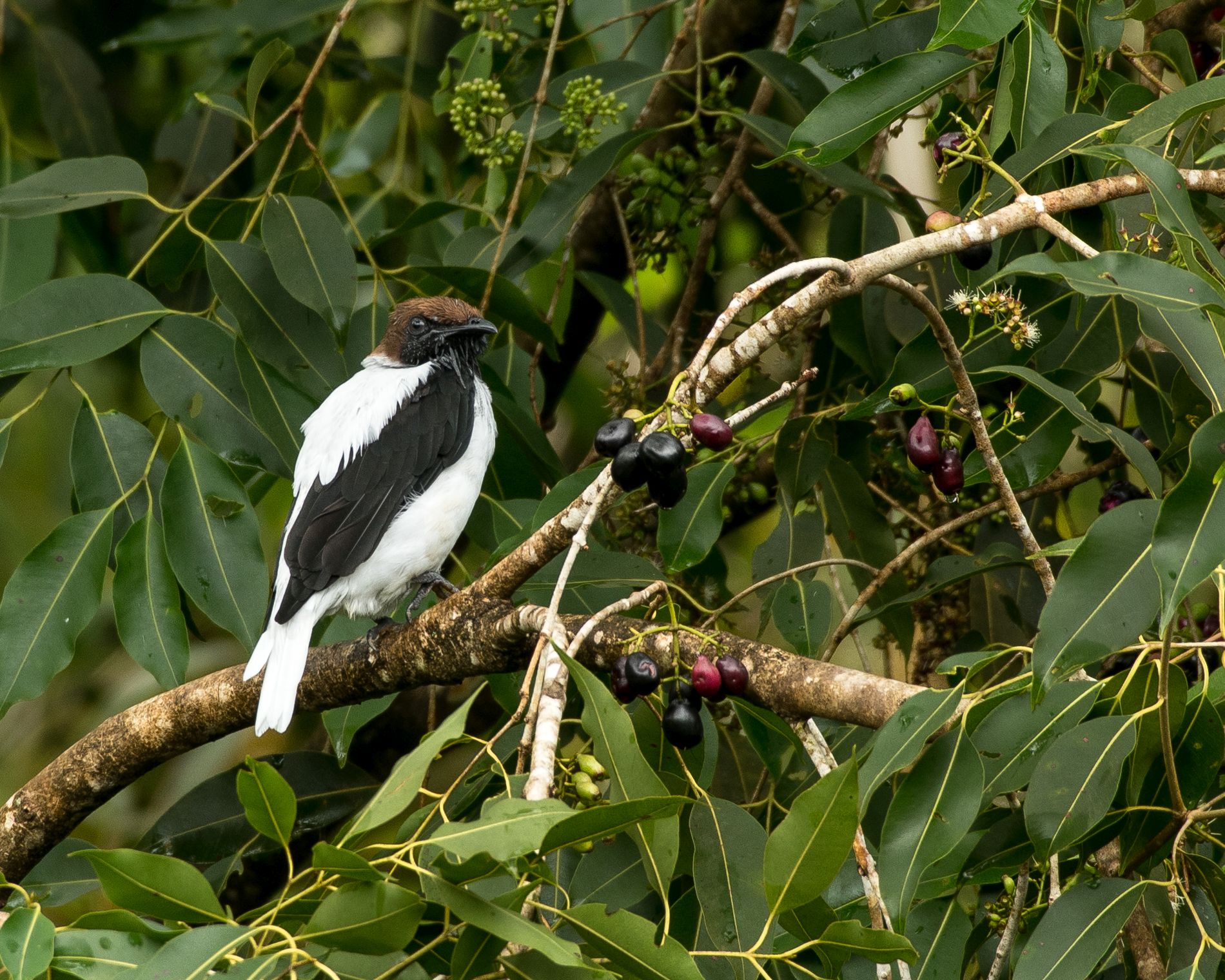
If the security patrols are discontinued immediate threats are posed through irreversible damage from potential expansion of encroachment into the protected areas and by illegal hunting. AWNC’s conservation of threatened species will be at risk through termination of ongoing monitoring of oilbirds, bats and other small mammals. Long-term ecosystem health is monitored through these key indicator taxa, which may be at risk of local extirpation (e.g. oilbirds). If lands of the AWNC have to be mortgaged or sold to ensure survival of the Trust, their protection will cease entirely.
The project activities include:
1. Continued monitoring and patrolling of the AWNC protected lands (5.4 sq km) through a combination of compound, mobile and forest patrols. Specifically, the grant will be used to fund the continued employment for 4 security officers for 12 months and the purchase and strategic installation of identification and deterrent signage in all areas where needed.
2. Continuation of key conservation/wildlife monitoring programmes such as include oilbird counts, servicing of deployed camera traps and bat acoustic recorders. Voluntary Board Members will take over these activities in conjunction with various volunteers and other nongovernmental organisations. BIOPAMA funding support is required to maintain access to the survey locations. Each month 2 persons from the nearby community will be hired to clear and maintain the paths and areas around the survey equipment to prevent forest overgrowth and remove any hindrance to the monitoring personnel. They will also contribute to any preventative maintenance required to minimise threats from external pressures such as forest fires.
The COVID-19 emergency highlighted aspects of the AWNC’s operations which made the Trust vulnerable to external shocks and even threatened the very survival of the protected area. In the absence of adequate financial reserves, the failure of the eco-lodge business – the principal source of revenue for the Trust – was shown to have the potential to imperil the whole organization. In order to make its future operations more sustainable, thus sustaining the benefits of BIOPAMA RRG activities beyond the end of the project, the AWNC will undertake restructuring planning with a view to eliminating risks and enabling the Trust to fulfil its conservation mandate.
The “triple bottom line” objectives of the restructuring exercise are to secure the future of the AWNC by putting its operations on a sounder economic basis, whilst maintaining the positive social impact the AWNC has had on neighbouring communities – through the creation of good in-house jobs in conservation – and keeping the environmental objectives of the Trust at the forefront.
The AWNC has already commenced these restructuring activities, however the persistence of the COVID-19 pandemic, the continued absence of any revenue and dwindling financial reserves, means the BIOPAMA funding will provide critical supplementary support for the continued protection of the lands and biodiversity monitoring whilst the Trust continues to work on a sustainable solution.
Download the project infofiche
Asa Wright Nature Centre (AWNC)
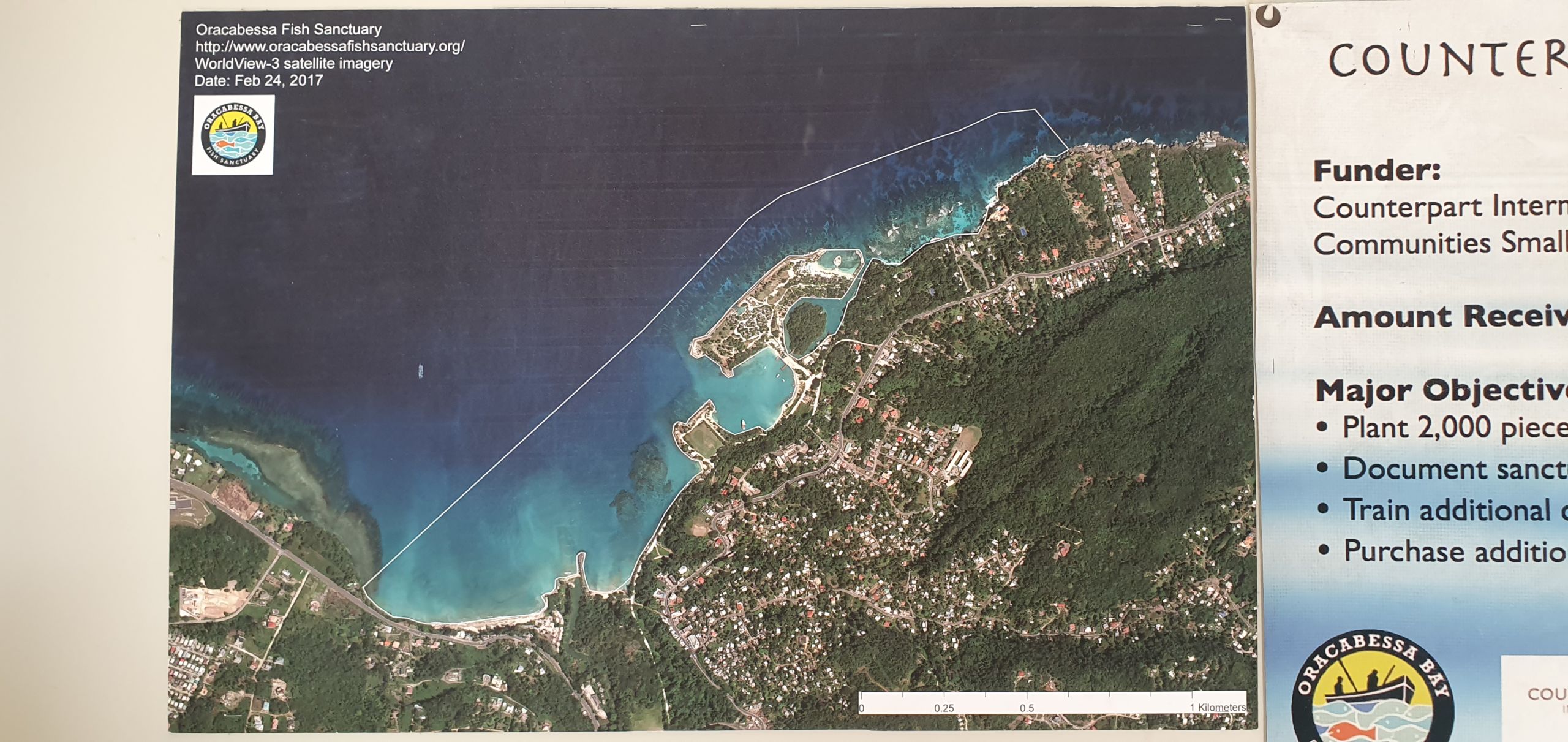
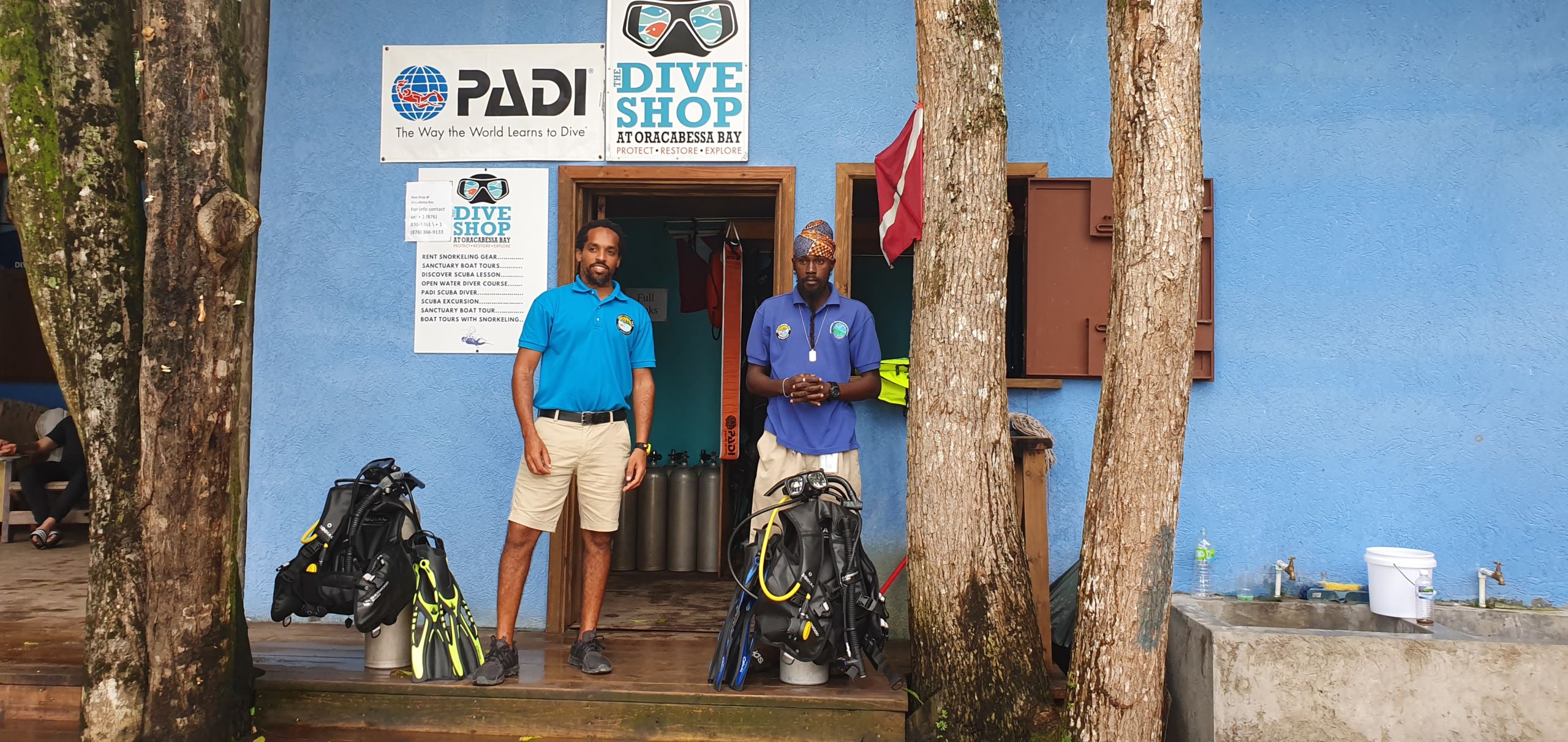
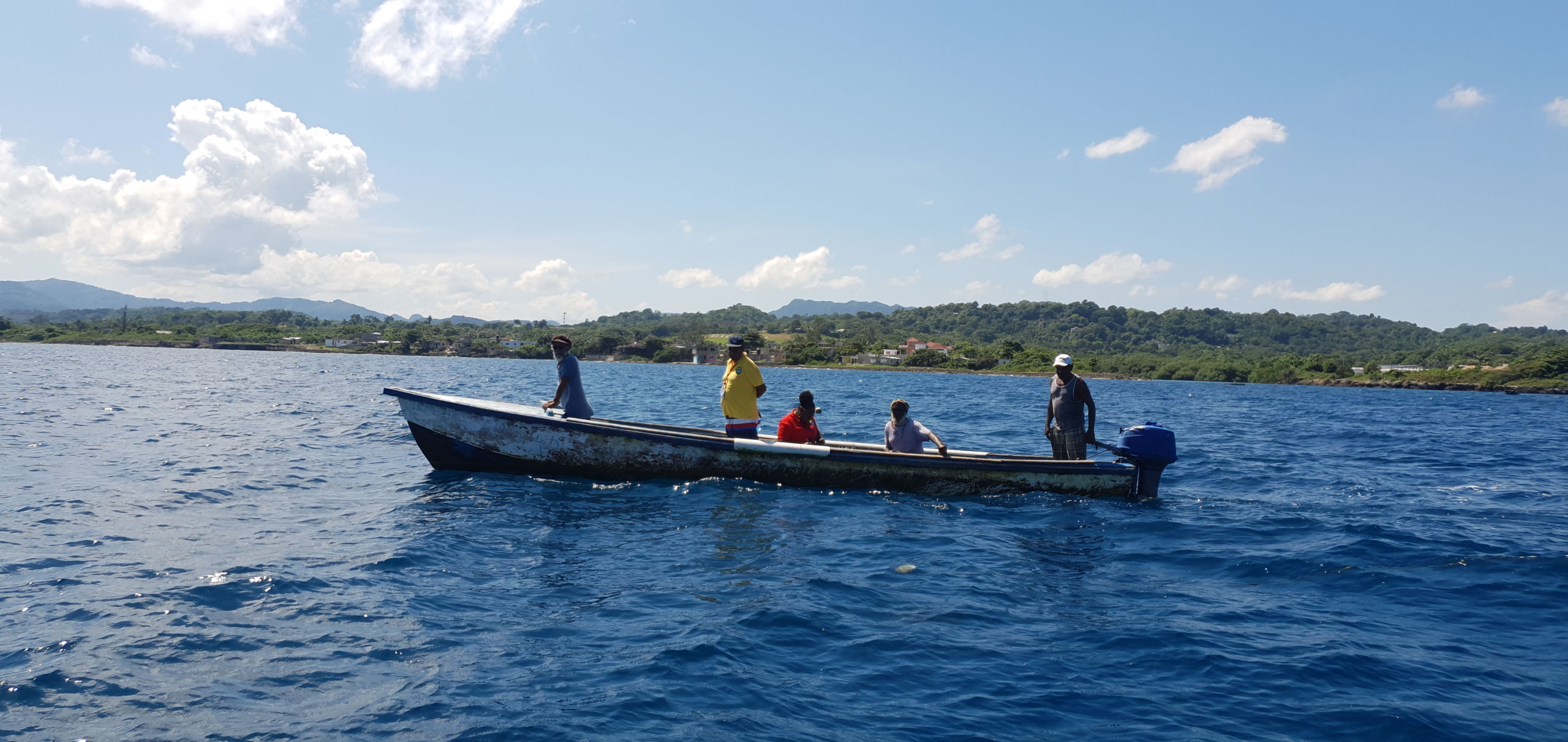
Oracabessa Bay Fish Sanctuary, 555542819;
The project aims to:
The project will protect the gains achieved by the Oracabessa Bay Fish Sanctuary in its 11 years of existence. Financial constraints pose a major operational threat to the protected area and could be disastrous for the local community of Oracabessa and surrounding communities that benefit from spill-over effects. The project will help maintain the current staff cohort comprised of fisherfolk and provide training and equipment to implement new technologies geared at improving operational efficiency.
From the protected area’s establishment in 2010, the fish biomass has increased over 60-fold, after years of overfishing the reefs in Oracabessa Bay whereby catch was found farther out. However, the stability and sustainability of the protected area is at risk, which the project will mitigate.
Although tourism has slowed, the industry will be key to the post COVID-19 recovery of the community. Continued protection of natural resources is paramount in providing the natural framework for the tourism industry to recover. This project will ensure that the conservation efforts continue to function throughout the pandemic. During this project, the marine protected area will benefit directly from the anticipated recovery of the tourism sector. Marketing support will increase customer awareness of the area’s SCUBA diving and snorkelling social enterprise and provide an online platform for better customer engagement.
Download the project infofiche.
The Oracabessa Marine Trust

Oracabessa Eyes Irish Moss Market: https://fb.watch/8Vuvf_EMZd/
Nelson’s Dockyard National Park, 555587192.
The project will address the following priority needs:
The project will facilitate the procurement of a marine vessel to enhance the capacity of the Nelson’s Dockyard National Park to conduct patrols, execute marine biodiversity surveys, facilitate greater education and outreach, and improve the management of the marine space of the Nelson’s Dockyard National Park.
This grant will provide funding to procure the required products and personal protective equipment for staff to undertake their duties safely and reduce the spread of COVID-19. The vessel will be custom built to suit the specific needs of the Nelson’s Dockyard National Park, with specific considerations given to enforcement and monitoring of the marine environment. Additionally, the vessel has been chosen to allow for activities within the entire boundaries of the Nelson’s Dockyard National Park, and to facilitate awareness and outreach activities such as educational tours.
The vessel is being manufactured in Ecuador for shipment to Antigua. Standard equipment and additional safety and navigational equipment will be installed. The commissioning of the vessel will include licensing by the Antigua and Barbuda Department of Marine Services. After the relevant inspections have been carried out the vessel will be launched. Once the operationalization of the vessel, is completed the NPA will immediately commence marine monitoring activities. The initial monitoring will include training activities for Park Wardens.
The Small Technical Grant project is expected to result in improvements in management, monitoring and enforcement of the marine and coastal ecosystems within the Nelson’s Dockyard National Park. In terms of management, the vessel is expected to facilitate regular patrols and allow the NPA staff to record and document human activities, challenges and threats within the marine boundaries of the Park.
The documentation is expected to be used as part of the information inputs towards the development of a Natural Resource Management Plan for the Park. The boat will also be used for additional ecosystem activities, inclusive of: sea turtle monitoring (including management of nesting beaches), Coral Nursery program, educational tours for schools, and environmental awareness activities. The boat will allow for enforcement of existing fisheries and marine management rules outlined in legislation. Currently, there are not marine patrols being conducted due to the lack of a vessel.
The NPA recently added a Marine Ecologist to its staff and will be embarking on developing and implementing a comprehensive marine and coastal monitoring program as part of its mandate to manage ecosystems in the Park. The boat will facilitate the implementation of the program and the work of the marine ecologist.
Download the project infofiche.
The National Parks Authority (NPA)
The project site is Kiritimati island in Kiribati, Central Pacific region.
The project is designed to carry out four major key activities that includes but not limited to, the development of a management plan for the 9 protected areas and undertake to provide key equipment and tools required to carry out effective and well-coordinated patrolling, protection and monitoring of the sea birds breeding and nesting sites and habitat not only in within the closed areas but along surrounding areas and generally around the whole island which is Government state owned land. The project is also expected to implement control of invasive species using cat traps in particular the leg held cat traps and live cat cages. Rat traps known as snapper traps and introduction of rat baits known as broadifacoum 2OR will be used in the control activities. In addition to these core activities the project is expected to carry out community awareness programs to communities, stakeholders Government departments and private sectors and the education sector in particular Primary and Secondary school children. The awareness program will highlight the IAS, the importance of biodiversity and certain laws and legislation in place and applicable to Kiritimati island and the PAs which have been designated as Wildlife conservation and environment protected areas under the Environment Act 1999 and the Wildlife Ordinance. The activity will also involve the establishment of educational and awareness mediums such as billboards and signboards showcasing important conservation messages to the public and visitors into Kirtimati island.
The protected areas of Motu Upua, Dojin, Tanguoua, Koil, Toyota, Mouakena and the three islets protected areas of Cook Islands, Motu Tabu and Ngaontetaake are located very far from the main villages hence the monitoring of these protected areas is very difficult without the monitoring vehicles such as cars and boat. The provision of monitoring vehicles and all the monitoring equipment to be provided in this project will enable the conduction of regular and efficient monitoring activities that will enhance the management of the protected areas.
The project will also improve and strengthen governance on the management of the protected areas through enhancing the support and participation of the local communities on the management of the protected areas, promotion of community awareness on the importance of protected area and biodiversity conservation and enforcement of rules for the management of the protected areas
Protection of the environment in the protected areas will also enhance the protection of the important birds population that are nesting at the nine protected areas on land and islet protected areas so the population of birds species will be increasing and prevent the extinction of the endangered species.
Download the project infofiche.
Department of Environment, Tuvalu


n/a
Reduction of coastal erosion and sand stabilisation through tree planting and acquiring necessary equipments and funding support the augmentation of the management of conservation areas.
This Project will actually focus on purchasing tools that will be needed to monitor the salinity and temperature on conservation areas which data will be useful to inform decision makers. The installation of beacons and bouys in one of the conservation area is a priority to ensure that proper demarcation. In addition, as climate change is one of the main issues that Tuvalu is facing at the moment; the Project focuses on trying to re-plant trees on degraded sites.
Proper demarcation of conservation areas and deployment of beacons and buoys will ensure that the public will be aware of the site and we will be able to ensure that illegal hunting of species is controlled and also for better protection and long term management of conservation areas.
Purchasing of tools use for monitoring of salinity and temperature is also important as we will be able to have available data and information which will be used for policy making.
Re-planting of degraded trees especially on the coastal areas will also assist in ensuring that we tackle climate change impacts (coastal erosion)
Download the project infofiche.
Department of Environment, Tuvalu


The TMRCA is currently not a legally protected area but a proposed PA
Priority for action identified is the Protected Area has inadequate materials based on the METT analysis. The report recommended the following on page 153:
The Tenkile Conservation Alliance (TCA) has 16 Project Officers, 16 Research Officers and 100 Rangers on staff. This grant will enable all of those staff with the necessary equipment and training they need to map the Torricelli Mountain Range Conservation Area (TMRCA) using Global Information System (GIS) technology.
Technical equipment such as phones and computers will be purchased. The engagement of all landowners to identify the special management areas (no-go zones) and areas for sustainable land use will lead to the inclusion of women, an increase of local leadership and improve community awareness of the benefits of the TMRCA.
Three TCA staff will participate in GIS mapping training with the University of Papua New Guinea to lead in the production of printed maps for villages and Government Agencies to use in the management of forests.
TCA Staff will also participate in training to use various phone applications such as Lukim Gather, SMART and Cybertracker to enhance the level of engagement, monitoring effectiveness and increased knowledge of biological assets and indigenous knowledge of the TMRCA. All of these activities will help TCA increase capacity in using technology and enable TCA to deliver tangible results in terms of mapping the TMRCA.
We expect that this grant will help the Tenkile Conservation Alliance (TCA) to achieve its capacity building goals which is to improve local staff capabilities in using technology – smart phones, computers, GPS and GIS mapping. These skills will improve the land use plans we have already created with more detailed maps produced. These maps and relevant local knowledge included in those maps and land use plans will directly inform local level, Provincial and National Governments of land boundaries and assets within the Torricelli Mountain Range Conservation Area (TMRCA). This will improve Forest Governance and protection from exploitation and illegal activity.
Download the project infofiche.
Tenkile Conservation Alliance
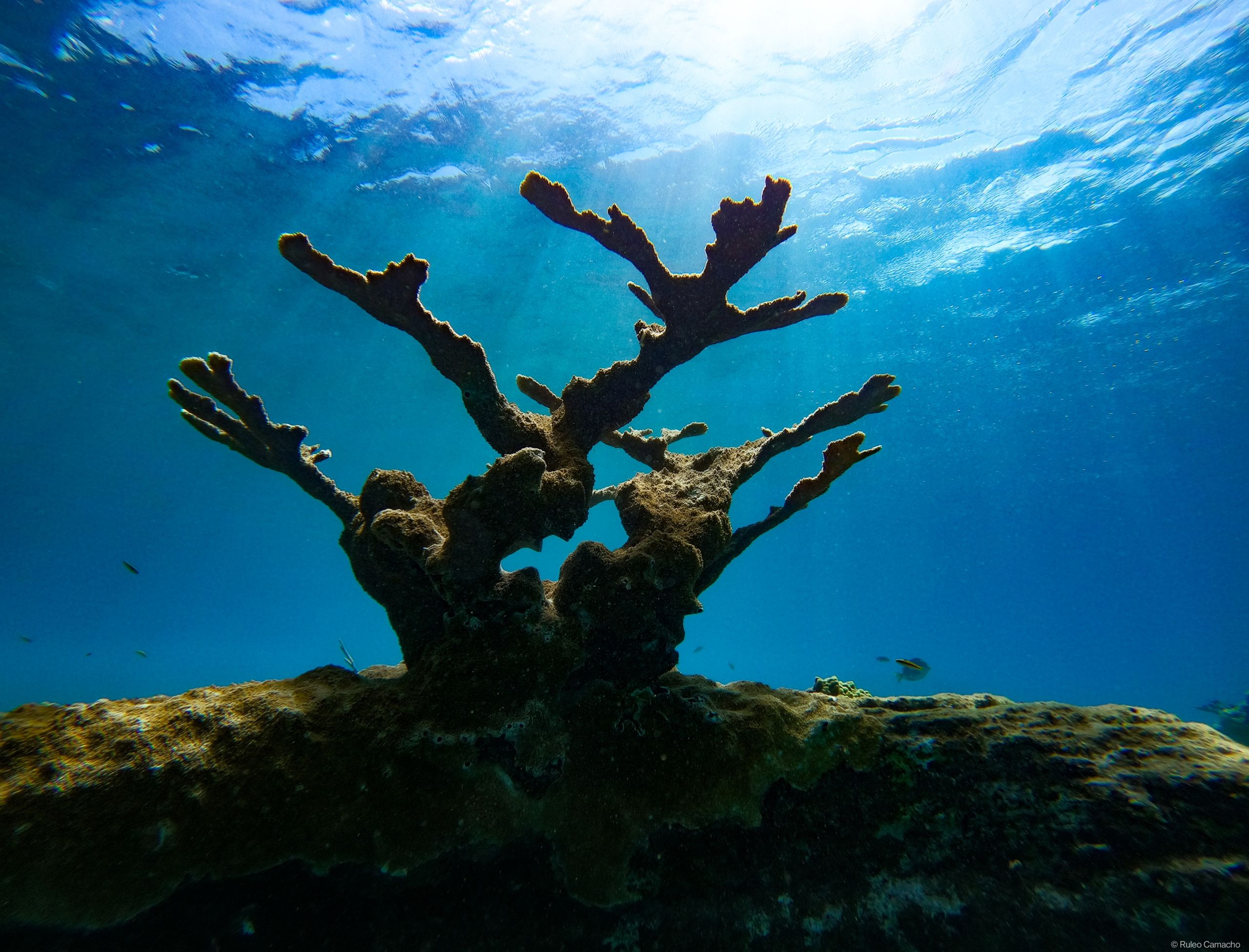
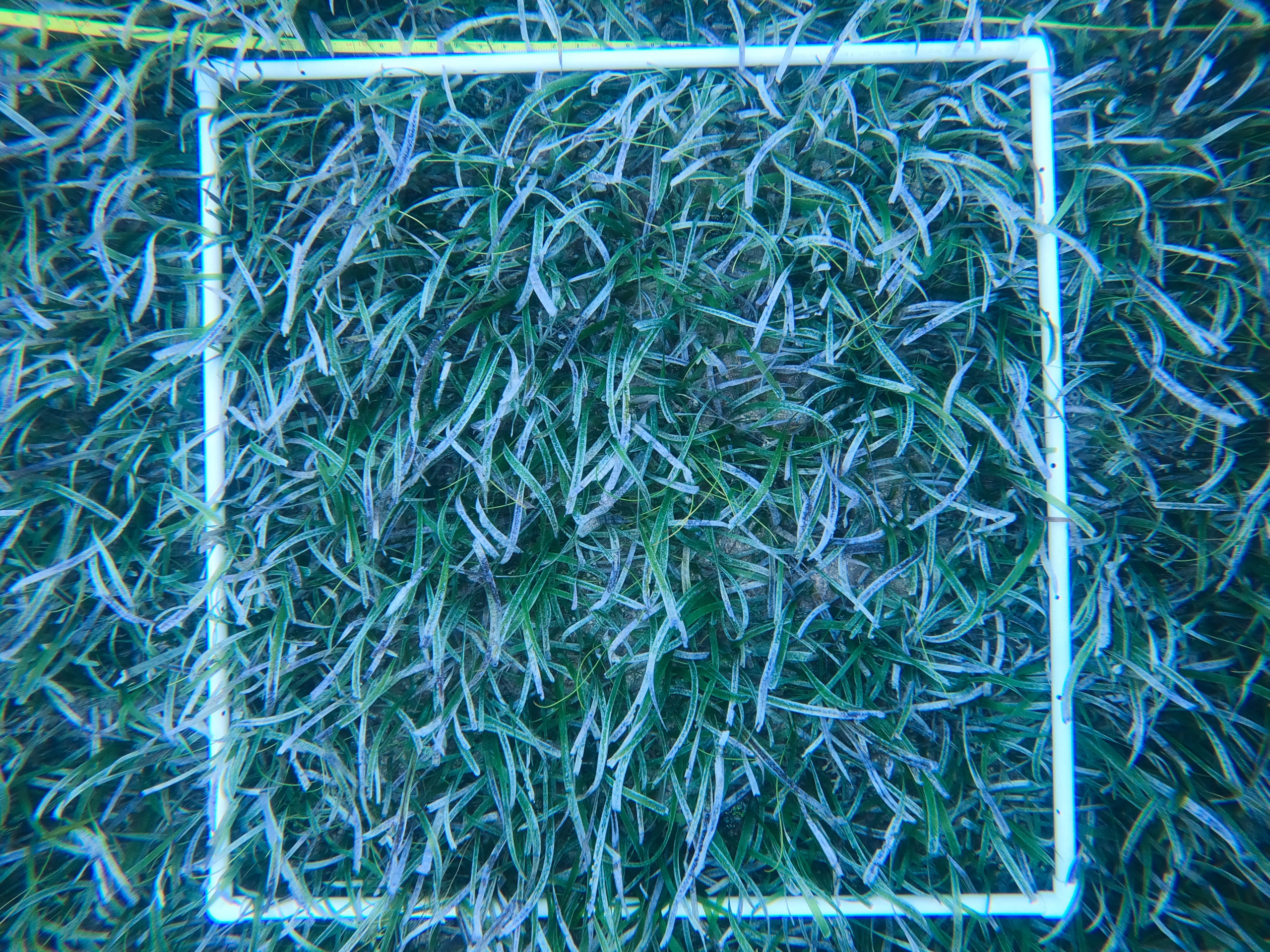
Waisali Rainforest Reserve, Yadua Taba Crested Iguana Sanctuary, Nakanacagi Bat Sanctuary – Wildlife Sanctuary, Sigatoka Sand Dunes National Park, Garrick Reserve – Nature Reserve, Sovi Basin Protected Area
WDPA IDs: 555592856, 9637, 15132, 9640, 555592859
This project is an excellent opportunity for the NTF to properly resource and equip NTF protected areas, as well as undertake research to improve the management of protected areas.
The NTF will purchase field equipment and Ranger Kits, for distribution to Rangers at all sites. At the same time NTF GIS Officer will provide in-house training to all Rangers in the use of SMART Tools and GPS. The new equipment will be used for site monitoring and critical management activities.
NTF will purchase media and other equipment for the NTF Site Visitor Information Centres. These new equipment will be used for community and visitor awareness, and for the NTF Heritage and Young Hands Program (HIYH). The HIY program is implemented throughout the year with school children in the region.
A protected Area Management Effectiveness study of six protected areas managed by the NTF, will be undertaken by a consultant working closely with the NTF project team. The team will work closely with the key stakeholders including the provinicial administrators of site areas with traditional presentations, and participatory approaches of focus group discussions and meetings.
Quality data and information are essential to inform sound decision making for the NTF PAs. Through the provision of field equipment the NTF will improve field data collection and management of data by NTF Rangers. NTF rangers will expand the use of GIS as a tool for data storage, analysis and presentation and implement the use of SMART (Spatial Monitoring and Reporting Tool) as a monitoring and data tool. This will enable the NTF able to better monitor site indicators across the NTF PAs and provide management with good data analysis.
At the NTF Visitor Information Centres, the NTF will now be able to improve the provision of awareness and communication resources through panels, guides, brochures, and media.This will generate more interest in the site, expand educational information especially through the NTF’s Heritage in Young Hands Program, and increase opportunities for the visitor (both international and local) to experience and understand the conservation needs of the site.
The evaluation of Management Effectiveness of the six NTF Protected will lead to the design of proactive management of the NTF sites.
Download the project infofiche.
National Trust of Fiji


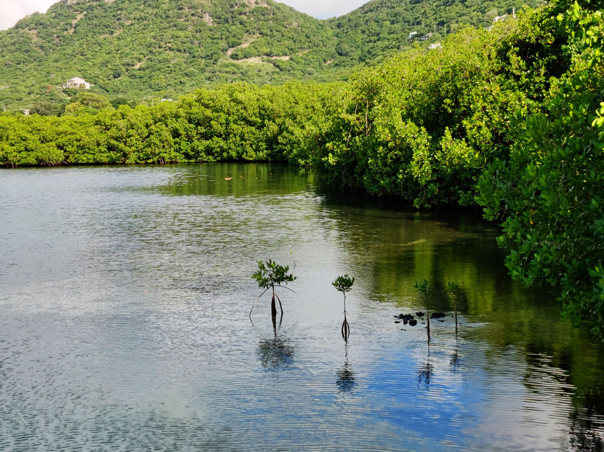
Faleaseela watershed and rainforest sanctuary
Vailoa mangrove ecosystem conservation
Malaemalu mangrove conservation
Manono Coral gardening and mangrve conservation
Letogo-Vailele watershe management
Lotosoa Saleimoa mangrove conservation
Siufaga Falelatai mangrove conservation
Lalomauga Biodiversity conservation
Uafato conservation area
Malololelei Recreation Reserve
Sili Biodiversity conservation
Aopo Upland conservation area
Falealupo coastal forest conservation
Taga conservation area
Matavanu crater ecosystem conservation
Tafua crater conservation
Satoalepai wetland conservation area
Lefagoalii marine conservation area
Saipipi marine conservation area
Salelologa lowland coastal forest
Positive outcomes are anticipated from the implementation of activities under the project, especially in improving the quality of our services on sustainable management and conservation of both terrestrial and marine PAs. Outcome of the PAME assessment will obtain data and information on the management and ecological status of at least 20 terrestrial PAs. Furthermore, it provides opportunity to improve knowledge and awareness as well as strengthen support and engagement of communities for conservational works such as restoration of heavily degraded areas, control of invasive species and biodiversity monitoring.
With the provision of well-equipped equipment and tools, this ensures improved operation through efficient and effective maintenance services and landscaping of terrestrial PAs in order to enhance ecosystem services and maintain environmental scenery beautification. The fully-equipped marine survey boat will help improve management of marine and coastal ecosystems/biodiversity conservation through; (i) regular research and monitoring/surveys/restoration activities (ii) management/conservation of species of interest and conservation concern including invasive operations, and (iii) effective surveillance and enforcement of marine PAs in order to improve compliance with existing regulatory mechanisms and measures.
Download the project infofiche.
Ministry of Natural Resources and Environment – Samoa


Palau Protected Area Network (555645482, 555645476, 555645489, 555645470, 555645464, 555645490, 555645471, 555645465, 555645478, 555645466, 555645479, 555645492, 555645473, 555645467, 555645480, 555645461, 555645499, 555645474, 555583351, 555583342, 555584966, 555583317, 900813, 555583344, 555585897, 555583325, 555585976, 555583335, 555583346, 555583156, 555583347, 555583370, 555583310, 555586416, 220010, 18256, 4247, 220009, 220005)
The PAN Office, on behalf of the network, aims to achieve the following outcomes:
Download the project infofiche.
Ministry of Natural Resources, Environment, and Tourism, Republic of Palau;
Protected Areas Network, Republic of Palau