For better user experience, please use another browser.
12 Protected Areas
The GPS survey equipment will be used to carry out scheduled, accurate mapping of CCA boundaries and other biodiversity and conservation spatial gaps across Vanuatu. Accurate data collection using the surveying equipment will improve national and provincial government data regarding land use across islands, inform better strategic island-wide environmental assessments, including plan/zone development. Derived information from collected data will also assist the national government to meet international reporting obligations, particularly for the post-2020 Global Biodiversity Framework, which focusses on the percentage of land area under protection to adequately progress towards global biodiversity targets.
All (12) targeted CCAs (registered and pending registration CCAs) will have sign boards installed within the CCAs. The signboards will communicate CCA boundaries, including significant biodiversity information and governing systems. Two sign boards will also be installed in Luganville (urban centre of Santo), to provide general protected area awareness in a high-pedestrian traffic area for the purpose of increasing communication to the public about conservation areas.
The purchase of a 4WD vehicle for Santo DEPC will help increase the support offered to CCAs by providing more flexible and efficient transport options for the DEPC extension officer in Santo. This will also increase the in-person contact between the DEPC extension officer and communities in protected areas, providing an efficient way to collect community concerns and address community challenges.
Download the project infofiche.
YUS Conservation Area
As customary landowners, the local communities of YUS are key stakeholders in the YUS Conservation Area’s management and represent the key beneficiaries of the social and environmental benefits the YUS Conservation Area provides. With the recent designation of the YUS Conservation Area at the landscape level – in accordance with Papua New Guinea’s recently developed Protected Areas Policy and IUCN’s Category VI protected area classification – the YUS communities’ management and implementation of ward-level Land-use Plans will play an increasingly vital and central role in the management of the YUS Conservation Area as a whole. The mosaic of the area’s 18 ward Land-use Plans collectively represents the YUS Conservation Area management plan, with key issues and trends informing the focus and provision of technical assistance through TKCP and other partners. Through the independent assessment of the YUS Conservation Area’s management capacity and effectiveness, both TKCP and community leaders/landowners in YUS will benefit from the identification of priorities and constraints, which will allow further discussion, planning, and response to strengthen the YUS Conservation Area’s cooperative management and governance. Given the YUS communities’ intricate relationship and heavy dependence on their local natural resources and ecosystem services, community resilience and sustainable resource management represent a core foundational objective for the YUS Conservation Area. The SAPA assessment process will provide opportunity for both the communities and TKCP to approach these impacts more directly and to work toward the development and integration of key social impacts into the YUS Conservation Area’s management, programmatic interventions and the communities’ pursuit of key government services and assistance.
Download the project infofiche.
Uafato Conservation Area (ICCA), Falease’ela Rainforest (ICCA)
Through increased opportunities for income generation, the project aims to support two rural communities in Samoa to work towards improving the livelihoods of the local community and enhance the resilience of these local communities to major shocks caused by the COVID pandemic. Simultaneously, increased community involvement in Protected Areas management will strengthen resilience to pandemics and Global Climate Change. The project will promote the implementation of existing objectives in relevant management plans such as the Uafato Conservation Area Management Plan and the Faleaseela Watershed Management Plan. Such objectives include the management of threats to Samoa’s National Bird, the Tooth-Billed Pigeon or Manumea, and other native fauna, such as from invasive species and hunting. The project will also focus on the restoration of degraded rainforests, including the planting of native trees and the raising of environmental awareness on the links between human health and the health of natural ecosystems and biodiversity.
This Rapid Response Grant will be used to empower, up skill, equip, and train local people in two community conservation areas/key biodiversity areas where people are experiencing a loss of income due to COVID-19. In addition to COVID-19, the communities are also experiencing negative effects of climate change. The project will result in improved livelihoods and also address the need for well-informed and well-trained nature tour guides in community-based conservation areas where the Manumea is believed to exist. The project will also work to establish ecotourism, provide training in bird identification and monitoring in these Manumea friendly Villages (MFV), and will work to improve livelihoods and income for local families. It will empower the villagers who have been adversely affected by the downturn in the economy due to COVID-19 to become guardians of their natural resources (e.g., the Manumea and the rainforests).
Download the project infofiche.
Sirebe Protected Area, Siporae Protected Area
Forests in the Mt. Maetambe and Kolombangara River Corridors are under high threat from large-scale commercial logging activities. Surrounding many of the protected areas are active logging activities. Furthermore, illegal trespassing by logging companies into the protected areas is common. To help ensure that the protected area boundaries are respected, rangers need to do weekly boundary surveys to monitor the movement of the logging companies. Due to the COVID-19 pandemic, the conservation project in both areas came to a standstill. The expected income from PES crediting could not commence due to postponed and delayed validation and verification audits. This project is specifically designed to help the Protected Area management committees to bridge the period of non-income and to mitigate the current logging threats in the area. Besides helping the rangers to carry out patrols and surveys, the project will also contribute towards building small accommodations for rangers within the protected areas so that they may stay within the protected area for longer periods of time, as well as increase their presence.
YUS Conservation Area
The long-term sustainability of the YUS Conservation Area, and the protection it provides for the conservation and sustainable management of natural resources across the landscape is primarily dependent on the continued endorsement and support of the local (indigenous) communities and customary landowners among the 50 villages of YUS. The structures, systems, and processes for governing and managing the YUS Conservation Area must be aligned to recognize and support the interests and priorities of the YUS communities, as they are the owners and stewards of their landscape in perpetuity. This project will facilitate the participatory review, alignment, and implementation of the YUS Conservation Area’s governance and management mechanisms in support of the communities’ collective leadership, agency, and participation.
These impacts will be realized through the achievement of four mutually reinforcing results:
Kamungi Conservancy, Kenya.
TBC.
The expected change to be brought about by the project will be to actively involve the local communities in conservation efforts, through the creation of buffers to the National Parks, giving them control over the conservation efforts which directly affect them, whilst also incorporating livelihood improvements such as job opportunities, long term and sustainable revenue stream to enhance community ownership and food security through HWC mitigation.
Photo Credits: Richard Moller
Download the project infofiche.
Tsavo Trust

Mount Diablo and its environs, St Ann
The Pilot project will address the following:
The project seeks to pilot an approach that will allow for a dedicated team of forest rangers (between two to four), equipped with needed resources to address identified gaps in patrol planning allowing for improved enforcement, while also supporting improved governance and management. Successes from this pilot will be replicated with additional response teams established in other targeted areas island wide and are reliant on achieving the following outcomes and activities.
Outcome 1 – Increased Forest enforcement and governance will include the development of mobile emergency rapid response procedure documents (SOP); conducting Mobile Response Procedures & Reporting training, procuring necessary tools and equipment to support initiatives, conducting Forest Law & Investigation training; Conduct UAV/Drone Operation training, erecting perimeter fencing to support boundary marking activities, fabricating and installing signage to support boundary marking and visibility activities and launching mobile emergency rapid response and conduct post impact evaluation. The project will also include stakeholder partnership meetings / community engagement meetings held to support establishment.
The development of an effective mobile emergency response team would provide the following expected change(s):
Download the project infofiche.
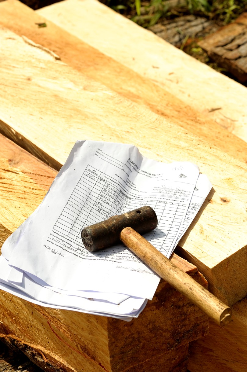
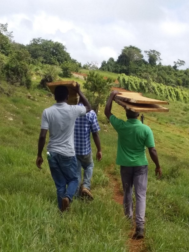
Forestry Department

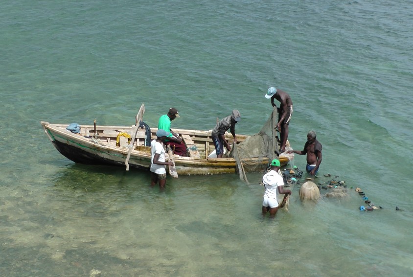
Turneffe Atoll and Lighthouse Reef Atoll
Support local communities’ initiatives aiming to enhance the livelihoods of local people whilst effectively contributing to protected areas management.
Assessing biodiversity viability.
Establishing a science-based roadmap to revive Caribbean marine megafauna in MPAs can be achieved through the following activities:
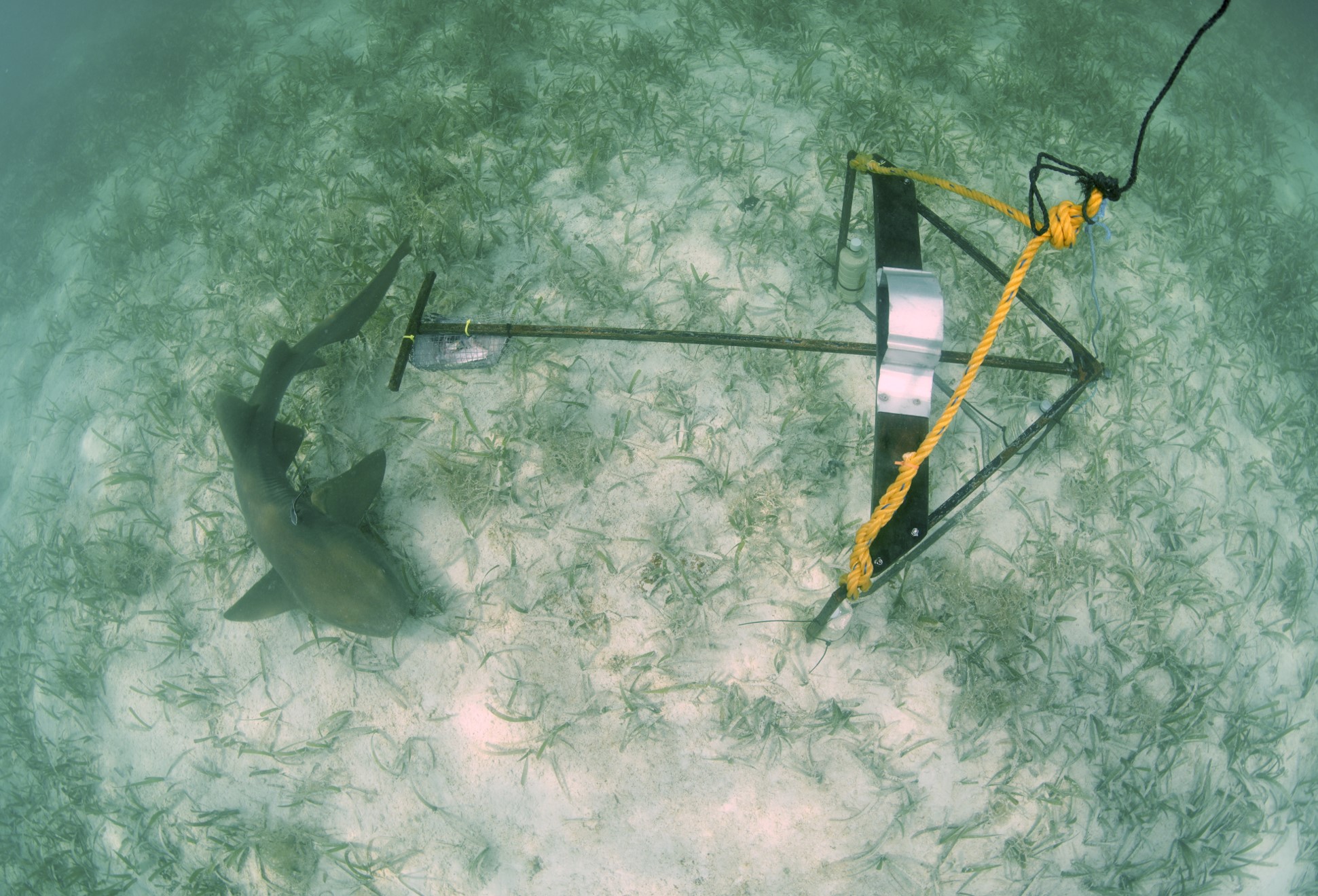
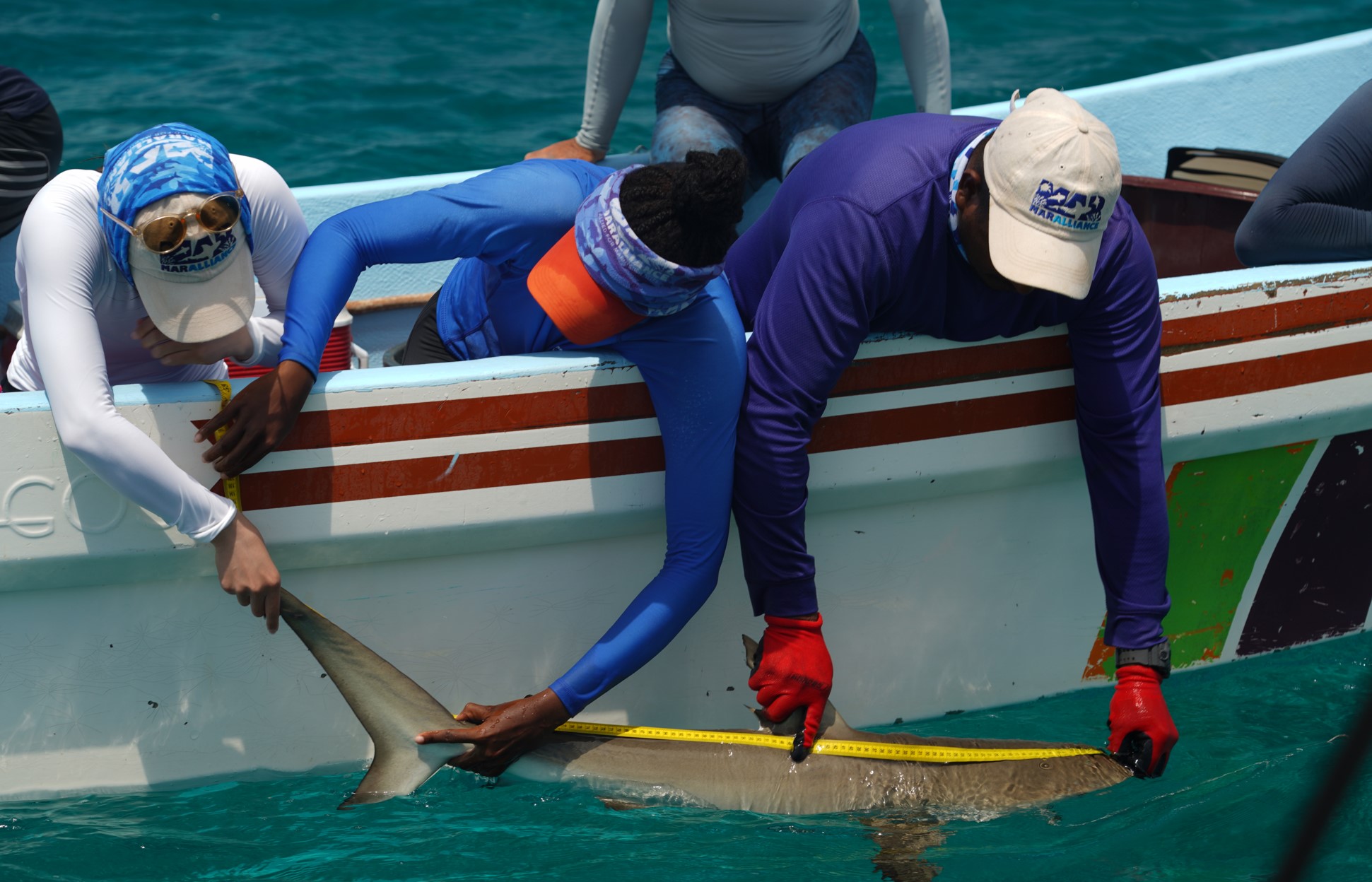
Through long-term monitoring efforts, the project aims to determine whether the rewilding of marine megafauna is a sustained phenomenon at Turneffe and Lighthouse Reef Atolls. Results are expected to galvanize continued management efforts, inform management plans for the respective atolls, and demonstrate that, with strong stewardship practices, populations of long-lived and late maturing marine megafauna can rebound. The demonstrated success of the MPA model in place at Turneffe Reef Atoll and Lighthouse Reef Atoll will guide justification for replication at other sites.
Ultimately, the project will provide an empirical basis for measuring successful rewilding of ecologically and commercially important marine species throughout Belize and other parts of the region.
Download the project infofiche.
MarAlliance
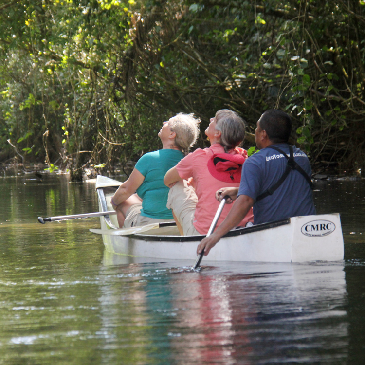
Bladen Nature Reserve;
Maya Mountain North Forest Reserve;
Golden Stream Corridor Preserve
Enhance the management and governance of priority protected areas by addressing existing limitations.
Realising that protected areas management is people centred, this project aims to change the perception that protected areas are unnecessary and mere land areas locked away from the public. While working toward changing this perception, the project will change the current levels of awareness of rules and regulations related to protected areas by providing education and outreach campaigns on the subject and improving management presence in key hotspots where illegal activities occur within the protected areas. The goal here is for an eventual transition from enforcement to compliance of rules and regulations. Ensuring clear delineation of boundary lines by physically opening the lines and installing signs will assist greatly in creating the awareness necessary for an eventual status of compliance with rules and regulations. To achieve compliance the project will improve and build the capacity of the enforcement & compliance teams, providing enhanced protection for select protected areas in the Maya Golden Landscape.
Download the project infofiche.
Ya’axché Conservation Trust